Justin Petluk

About me
My name is Justin Petluk and I received my Bsc in Computer Science at University of Lethbridge in 2020.
During my degree, I explored GIS courses and was invited to work with Barrett-Henzi Lab
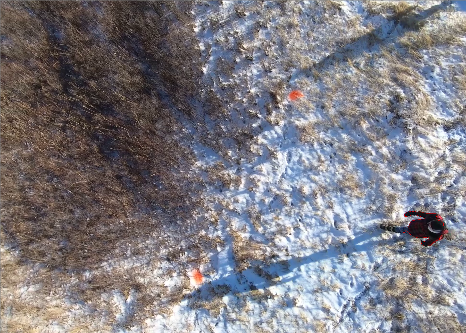
I started out with an Independent Study, to explore how an aerial video could be used to extract real-time gps locations of animals on the ground. We took to the coulies and recorded a video with a Gopro and used a handled GPS to mark the spraypainted coordinates, and I went to learn about image processing and OpenCV.
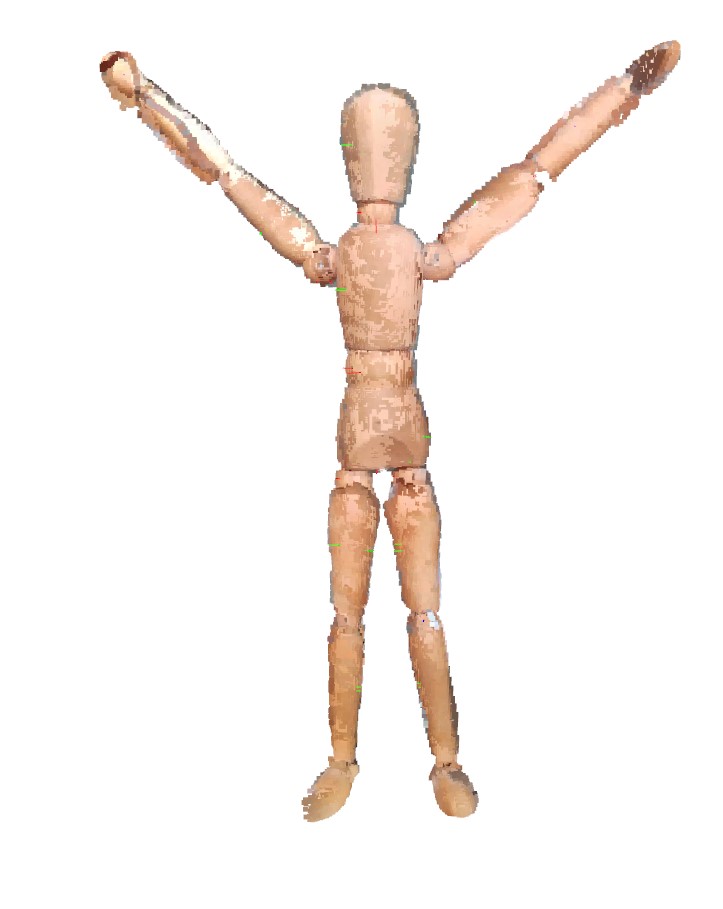
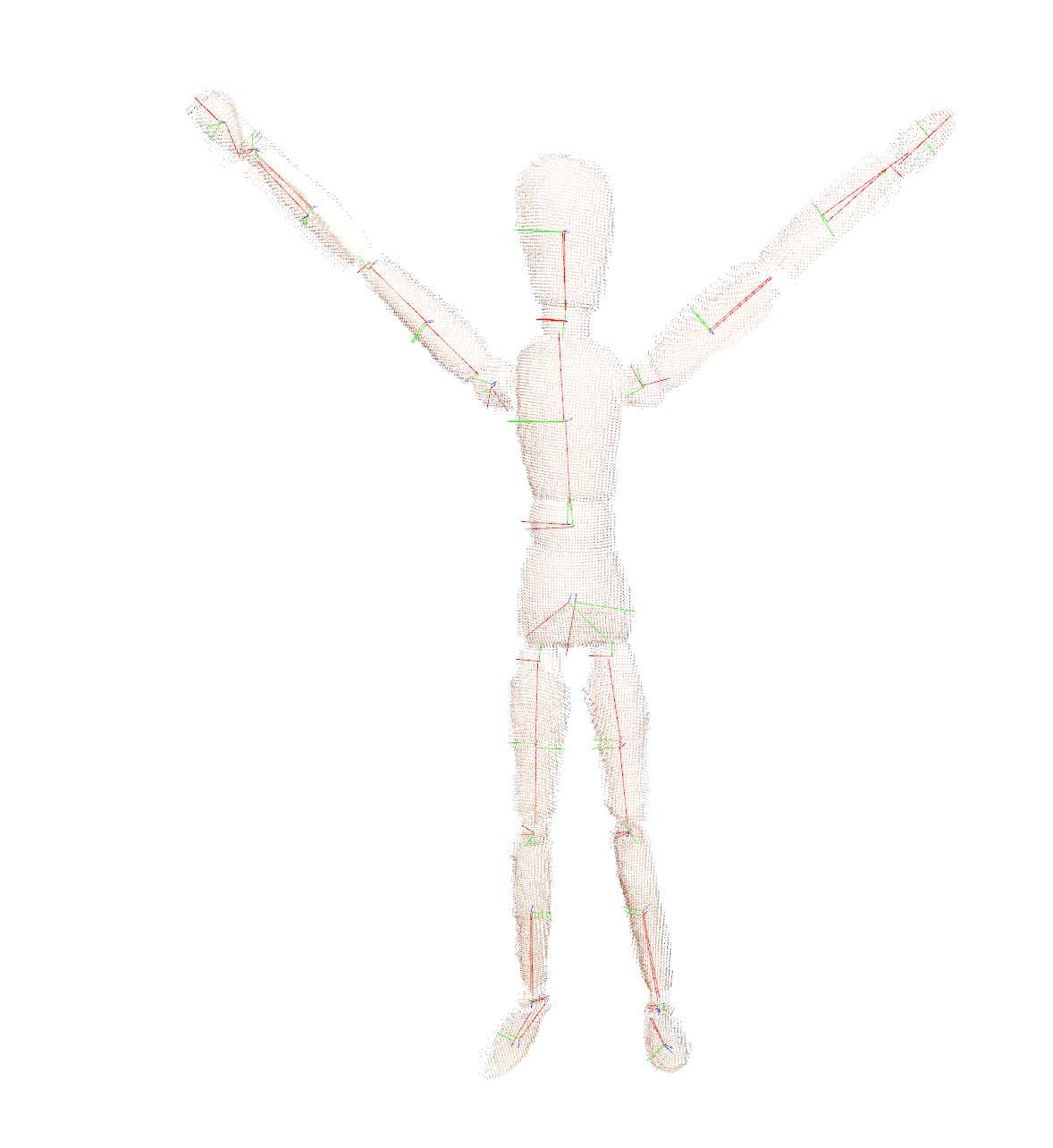
After that course concluded, I was asked if, given a depth camera, could I measure the length of a Vervet Forearm? I said “sure!”
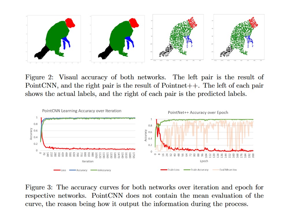
So then I went on a journey to learn about Pointclouds, and after my Advanced Data Processing and Recomendation Systems, I started to learn more about how data is used. I took with an interest on how to analyze Pointclouds with Point Cloud Library, and Open3D as shown in 3DMeasure. Additionally, I decided that this could be done automatically, so I did an Independent Study on Pointnet, Pointnet++ and PointCNN, as well as clustering methods to learn how this data worked in the case of animals. I was generously lent taxidermy animals for testing.
I then took multiple Remote Sensing courses to learn how this type of data was handled and how to transform data into valuable information.
I continue to explore the realm of Remote Sensing, and with a soft spot for animals and the outdoors, I am destined to continue on this path until something great happens.
Along the journey, I joined the Digital Blackfoot Library project to bring artifacts around the world back to the Blackfoot People, and built People Tracker to assist data collection for a study in Barrett-Henzi Lab.
Projects
3DMeasure
3DMeasure is a collection of research, experiments and findings through a collection of libraries/packages with the goal to measure animals.
.PNG)
PeopleTracker
PeopleTracker is an OpenCV Object Tracker that is used to collect data about something in a video. Here, it is used on people but has many other applications as well.
![]()
![]()
UofL Study (A GIS Independent Study)
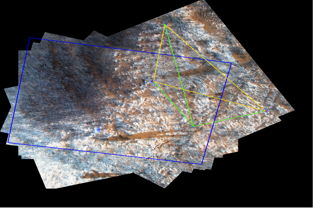
This Independent Study was designed to track and gather data from a aerial video. It stitches the images together using RANSAC and estimates the viewport of the camera over the images. It then projects the recorded data onto the stitched image and uses the GPS locations to trianglulate the target’s location in UTM format using euclidean distance.
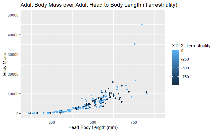
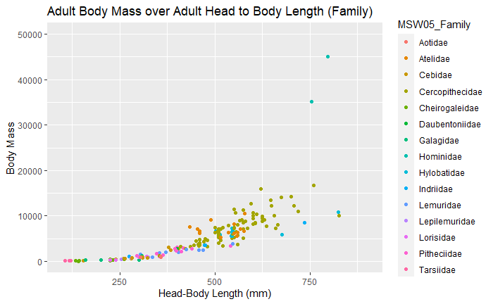
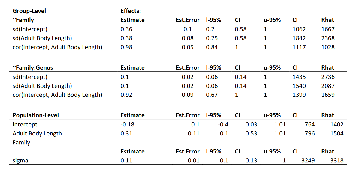
Applied Baysian Statistics, Primate Allometry
This study was a precurser to my interest about modeling measurments that were taken by primates, and using baysian statistics to evaluate the relationship between non-human primate bone lengths and their relationships to mass. The idea was that if there is a strong enough relationship, a longbone length could be used as a strong prior for estimating the mass of an individual, in addition to other data if and when it’s available.